Log in
All resources
Create a design
167 Free Images of Maps Of New England
bibliothèque nationale de france
john rocque
remigius parr
john rocque's 1748 map of london and adjacent country
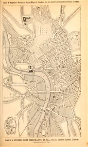
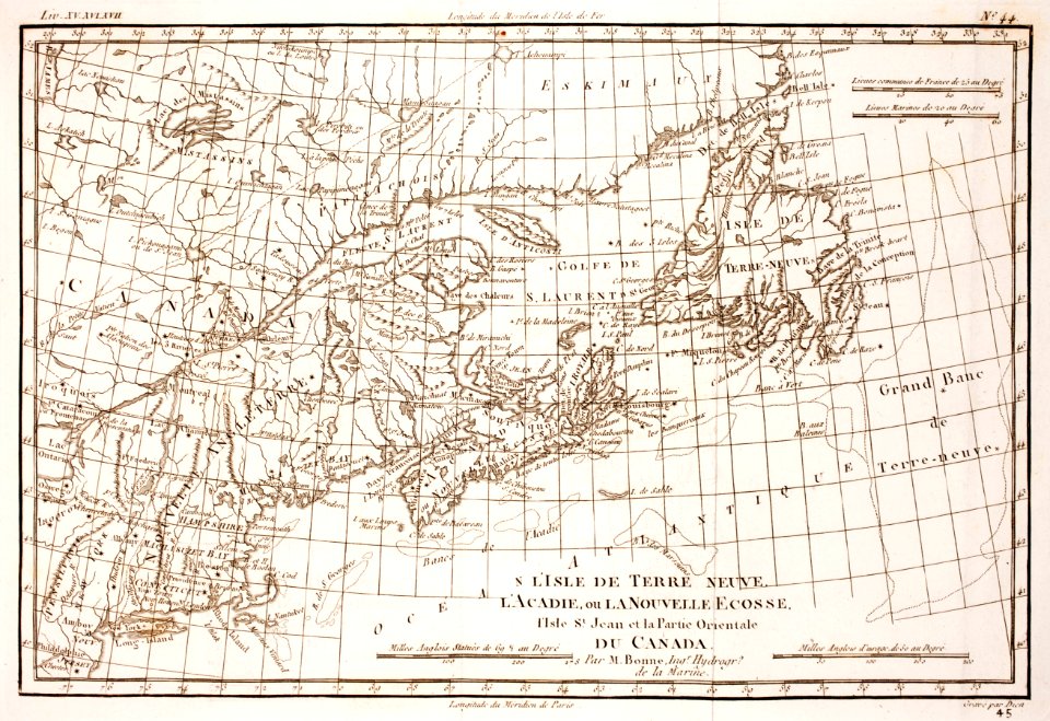
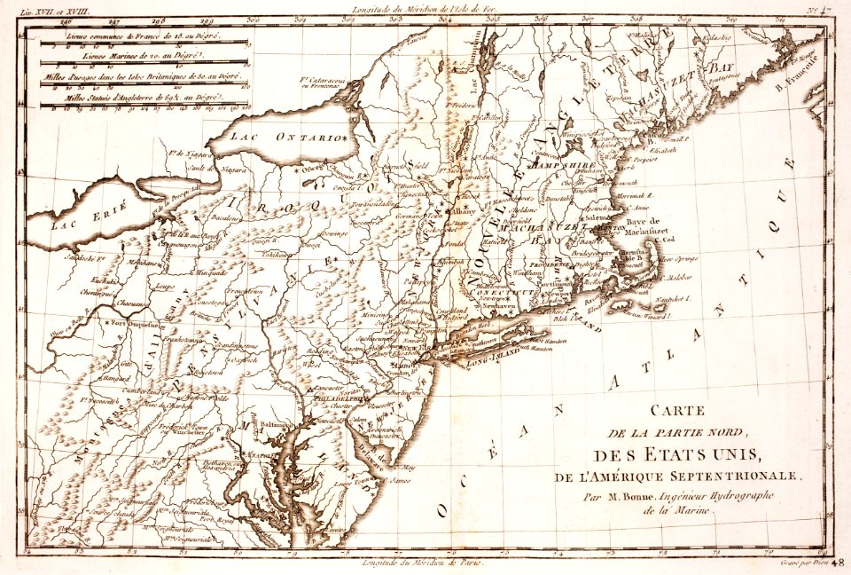
old maps of new england
cary's new itinerary (1815)
john rocque's 1746 map of london
maps by thomas kitchin
thomas kitchin
latin-language maps
1821 maps of the united states
maps by john cary
a class-book of modern geography (1898)
old maps of the river thames
a class-book of modern geography (1898)
old maps of liverpool
a class-book of modern geography (1898)
maps of the lake district
maps from the earth and its inhabitants, vol. iv
old maps of hastings, england
atlas sive cosmographicae (gerardus mercator, 1623)
maps of north england by gerardus mercator
atlas sive cosmographicae (gerardus mercator, 1623)
maps of southeast england by gerardus mercator
atlas sive cosmographicae (gerardus mercator, 1623)
maps of england by gerardus mercator
maps by willem and johannes blaeu
1610s maps of the americas
lawrence h. slaughter collection of english maps, charts, globes, books and atlases
de nieuwe en onbekende weereld
old maps of northumberland
maps by thomas kitchin
historical collections of the state of new jersey (1852)
1852 maps of the united states
old maps of the polish-lithuanian commonwealth
1790s maps of poland
19th-century maps of somerset
cary's new itinerary (1815)
cary's new itinerary (1815)
19th-century maps of kent
19th-century maps of the isle of wight
cary's new itinerary (1815)
19th-century maps of middlesex
cary's new itinerary (1815)
19th-century maps of hampshire
cary's new itinerary (1815)
old maps of oxfordshire
maps by thomas kitchin
18th-century maps of cornwall
maps by thomas kitchin
english-language maps
maps by john cary
london
maps
prints by james gillray in the british museum
satirical prints in the british museum
maps in the library of congress
1777 maps of boston
maps from the earth and its inhabitants, vol. iv
middlesbrough
john rocque's 1748 map of london and adjacent country
remigius parr
john rocque's 1748 map of london and adjacent country
remigius parr
john rocque's 1748 map of london and adjacent country
remigius parr
john rocque's 1748 map of london and adjacent country
remigius parr
john rocque's 1748 map of london and adjacent country
remigius parr
john rocque's 1748 map of london and adjacent country
remigius parr
john rocque's 1748 map of london and adjacent country
remigius parr
john rocque's 1748 map of london and adjacent country
remigius parr
bibliothèque nationale de france
maps by john rocque
john rocque's 1746 map of london
remigius parr
john rocque's 1748 map of london and adjacent country
remigius parr
john rocque's 1748 map of london and adjacent country
remigius parr
john rocque's 1748 map of london and adjacent country
remigius parr
john rocque's 1748 map of london and adjacent country
remigius parr
john rocque's 1748 map of london and adjacent country
remigius parr
john rocque's 1746 map of london
remigius parr
john rocque's 1748 map of london and adjacent country
remigius parr
john rocque's 1746 map of london
remigius parr
john rocque's 1748 map of london and adjacent country
remigius parr
john rocque's 1748 map of london and adjacent country
remigius parr
historical
history
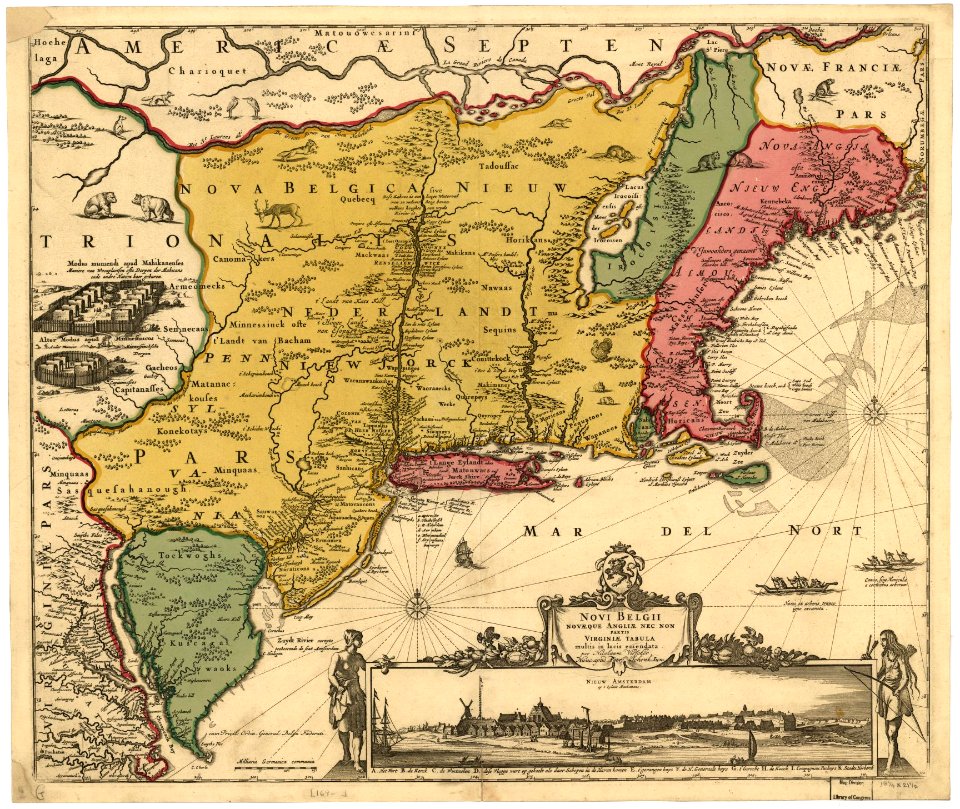
1650s maps of the americas
1658 maps
1740s maps of the americas
1747 maps of north america
old maps of new england
william henry bartlett
1696 maps of the caribbean
1690s maps of mexico
18th-century double hemisphere world maps
1730s maps of the world
18th-century double hemisphere world maps
1730s maps of the world
1914 books from the united states
orientalism
historical
history
geocentric model
1730 maps
john rocque's 1746 map of london
bibliothèque nationale de france
john rocque's 1746 map of london
bibliothèque nationale de france
mappe-monde geo-hydrographique (sanson and jaillot, 1674)
cartography of france
historical
history
the plumb-pudding in danger (cartoon)
caricatures of uniforms
maps of the captaincy general of cuba
maps of the history of florida
mappe-monde geo-hydrographique (sanson and jaillot, 1674)
carte du mexique et de la floride by guillaume delisle (1703)
bibliothèque nationale de france
old maps of the viceroyalty of new spain
the spanish borderlands
de nieuwe groote lichtende zee-fakkel (rijksmuseum)
maps in the rijksmuseum amsterdam
map of europe by guillaume delisle (1700)
university of washington
prints by william dent in the british museum
satirical prints in the british museum
101 - 167 of 167
/ 2


![Novi Belgii, quod nunc Novi Jorck vocatur, Novae q[ue] Angliae & partis Virginiae: accuratissima et novissima delineatio., 1671](https://cdn.creazilla.com/illustrations/10000934523/novi-belgii-quod-nunc-novi-jorck-vocatur-novae-que-angliae-partis-virginiae-accuratissima-et-novissima-delineatio-1671-sm.webp)